“TOWNSHIP OF THE HIGH GROUND”
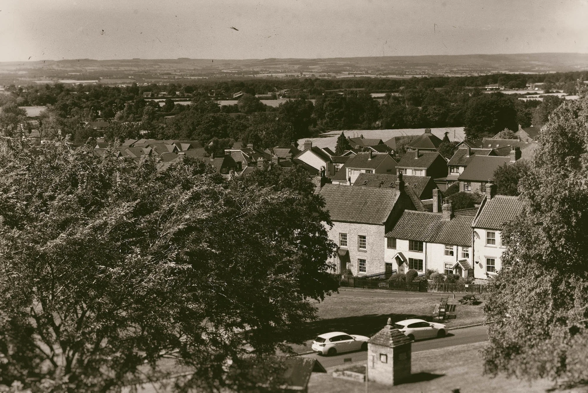
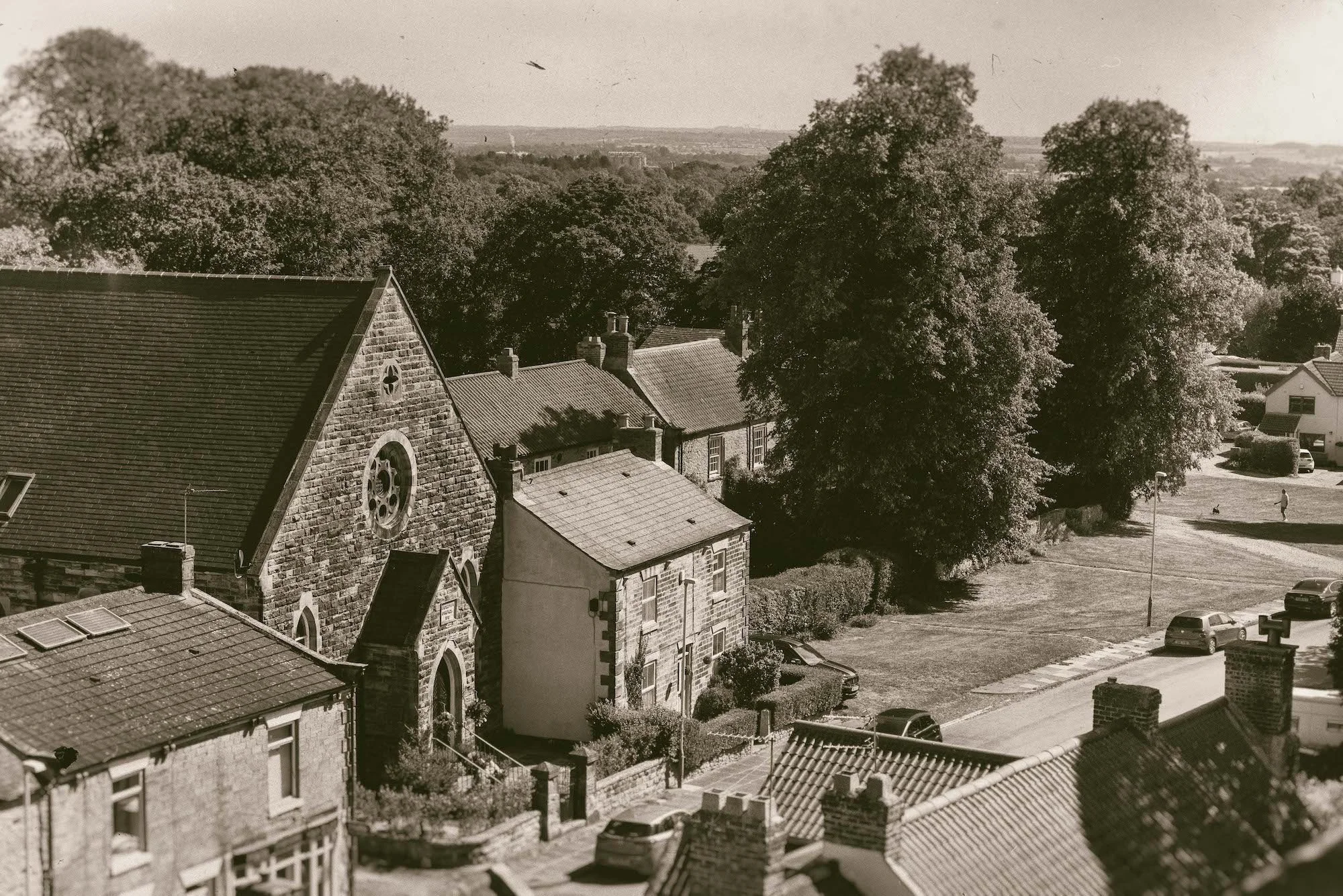
Heighington’s rural village scene is rich, simple and charming, with history very evident in the clear rooftop and tree-flled horizon, backed by long green views.
Origins
There are Iron Age finds nearby, but the name Heighington is probably Saxon, meaning ‘township of Hecca’s people’ or ‘township on the high ground’.
Although thought to be early medieval in origin, 1981 excavations suggest Heighington’s Norman church was built on the foundations of a 10th century church, suggesting late-Anglo Saxon origins. The village is first mentioned in the 1182 Boldon Buke (a survey of Durham’s parishes similar to the Domesday book) which, with other sources, indicates it had about 100 people living in small heather thatched cottages laid out around a green; the better houses were possibly cruck- framed.
Historical development
Possibly with late Saxon origins, it was the early medieval period which set the development pattern still evident today.
• The village was a significant administrative centre for many centuries.
• 17th, 18th and 19th century renewal created most of the buildings seen today.
• The rural village was eclipsed by industrial centres nearby (eg. Darlington), but it still almost doubled in size in the late 20th century
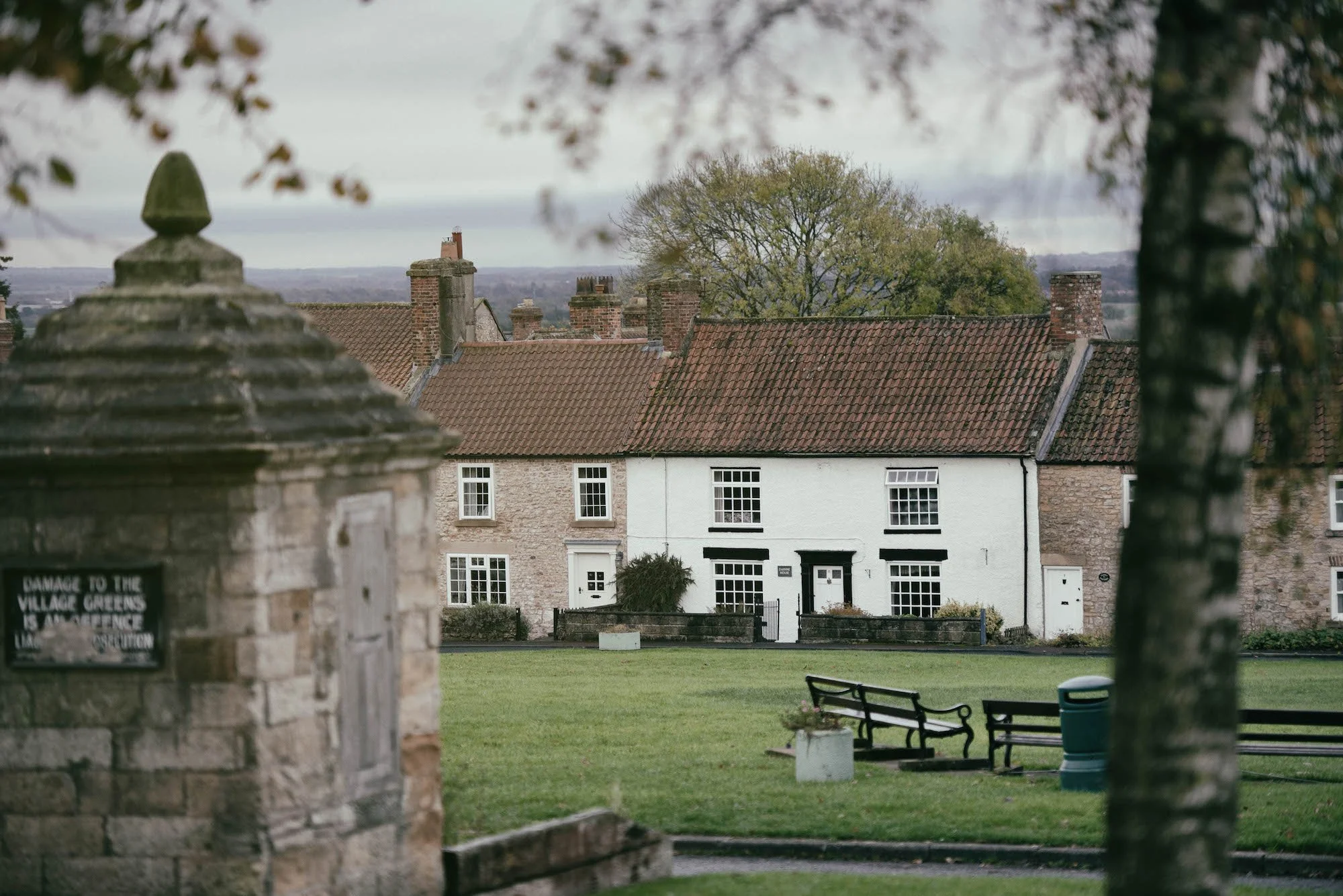
A traditional green village
Heighington was an important local centre for centuries. 17th, 18th and 19th century renewal left the built legacy seen today, dominated by single family dwellings and the communal village green.
Since 1974, Heighington has been in the north of Darlington borough but is traditionally in south-east Co Durham. It is strongly influenced by its elevation, south-facing topography over the north bank of Tees valley, and underlying magnesian limestone geology.
The familiar rural village scene is rich, simple and charming, with history very evident in the clear rooftop and tree-flled horizon, backed by long green views.
There is the strong sense of
a historic, well-organised community settled quietly in the countryside for centuries, still partly encircled by open fields and thriving as a desirable, well-cared for place to live.
Spatial characteristics
Distinctive historic plot layout and modest architectural characteristics create remarkable unity and appealing informal harmony.
The old village’s spatial presence in the landscape is still clear on the north, east and south sides, where it is still surrounded largely by open space. Post-WWII development to the west and south-west has harmed its spatial presence there.
• The crisp, organised, village green spatial pattern, ringed by linear plots, is a key characteristic that is strongly descriptive of its history. It was defensible, protected from the elements, and created communal green space for grazing and village life.
• The well-defined, largely unaltered set of routes shows essential historical movement 1.29 to, around and inside the village.
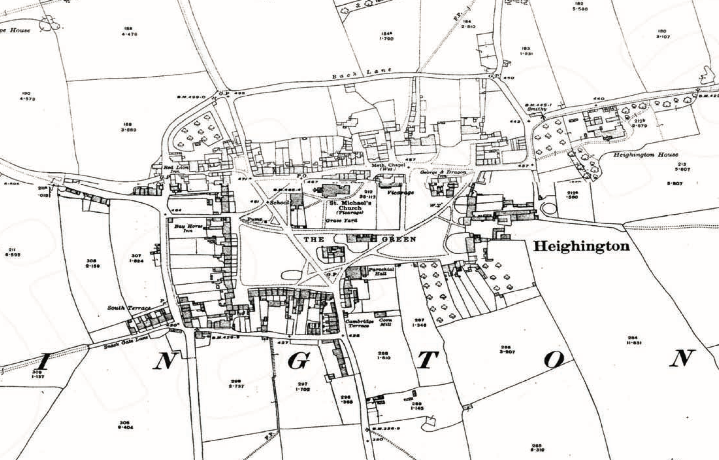
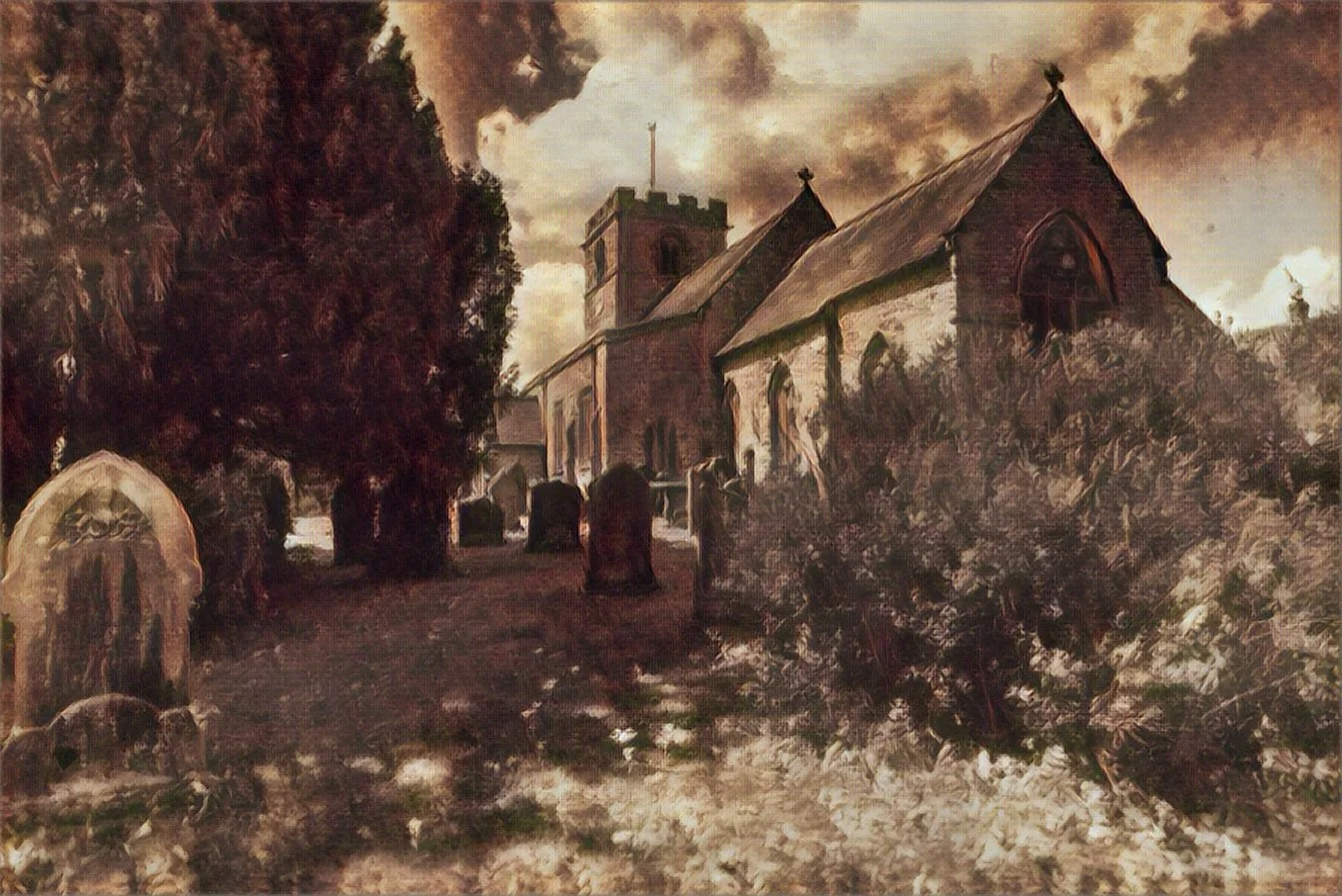
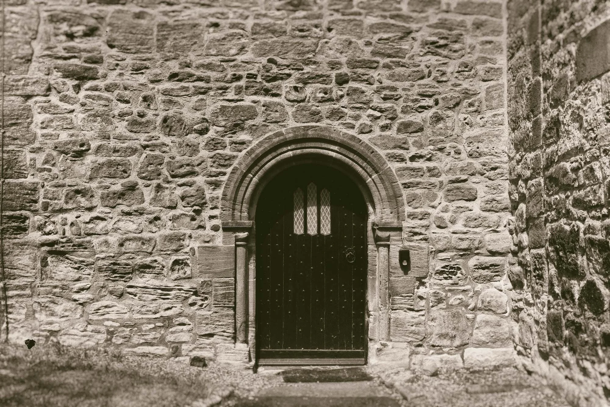
St. Michael’s Church
The present church was built c.1130 AD, over the remains on an even earlier Anglo Saxon church.[1] The church was extended in the 13th and 14th centuries. Among the many treasures to discover are the 14th/15th-century font, the pre-Reformation oak pulpit (the oldest surviving pulpit in County Durham), and the 16th-century choir stalls with their carved poppy-heads.
The bell tower houses six bells today, three dating from the 15th century and three from the 19th century.
The church is Grade I listed on the National Heritage List for England.